Managing flooding naturally: Part 1

Managing flooding naturally: Part 1

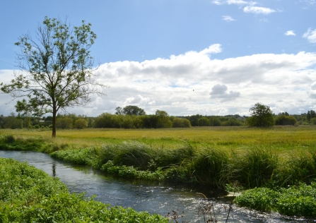
River Itchen at Winnall Moors © Steve Page

Less than two years after the UK’s last extreme flooding events, we’ve experienced another devastating spate of rainfall and flooding.

Communities and businesses have suffered greatly while the cost to people’s lives and the UK taxpayer is enormous. Just as before, recent media coverage, centred on a blame game between climate change, flood defence investment, dredging and so on - but the majority of commentators ignored the ‘elephant in the room’; land management.

The reality is that decades of disjointed land use planning, unsustainable agricultural practice and continued modification of our river catchments are exacerbating the effects of climate change.

We have removed the ability of our floodplains to contain and regulate the impacts of flood peaks while in parallel attempting to engineer a future-proof system facilitating more and more development and intensive agriculture, often in the wrong place and at great expense to the taxpayer.

Flooded path at Hockley on the River Itchen

© Jon Milliken

Dysfunctional floodplains

Over the years, we've changed the way floodplains work - and as a result have increased the risk of flooding downstream in our towns and cities.

'The Catchment Approach'

Looking back, Hampshire was particularly affected by the floods of winter 2013/14, with many local communities suffering flooding to homes, businesses and schools. In Winchester, our staff were involved in direct efforts, working with the Environment Agency and Winchester City Council, at our Winnall Moors Nature Reserve attempting to control the movement and interception of water as it approached the city centre.

Our experiences of this event, and observations across the county, helped demonstrate the benefits of specific forms of flood management, which we the Trust had been promoting for many years prior. This is the ‘catchment approach’.

The catchment approach is not a new concept; for many years Wildlife Trusts have been engaged in wide ranging partnerships promoting an integrated view of how our river catchments are managed. This has included driving forward projects to improve river water quality, enhance wildlife habitats and reconnect rivers with their floodplains – as we have in Hampshire and the Isle of Wight.

The term ‘natural flood management’ has emerged in recent years partly as a way of emphasising the multiple socio-economic benefits derived from many of these projects.

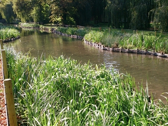
Winnall Moors Nature Reserve © Deryn Hawkins

Winnall Moors Nature Reserve © Deryn Hawkins

Slowing the flow 

The concept of holding water back and paying farmers to store water on farmland is now touted by decision makers as a potential solution, but has also resulted in a misinterpretation of what organisations such as the Wildlife Trusts, promote as natural flood management.

There is also mixed evidence about the benefits offered by ‘natural’ land such as trees and woodland, to intercept and reduce the energy of rainfall or peak river flows - and this is adding further confusion to the debate.

Winnall Moors Nature Reserve is immediately upstream of Winchester City centre, and we had recently completed a six year floodplain restoration project there. We restored part of the historic water system, by rebuilding working sluices, opening carrier ditches and reinstating extensive grazing to the floodplain. We also removed flood embankments along the river and raised the riverbed along previously dredged river sections (largely former flood defence activities of the 1960 & 70s).

At face value this work was about wildlife and habitats; Atlantic salmon, sea trout, otters, water voles, flower rich fen grassland, reedbeds, alder woodland and so on all benefitted. But we had been bold with our assertions that this work undoubtedly was providing a benefit to Winchester by reconnecting the river with its floodplain.

The 2014/15 floods saw Winnall eventually became a single lake - opening up the floodplain enabled water to disperse laterally and slow discharge into the city. This is a small section of the wider river catchment, which was draining too quickly into the river. The event reached such severity that the emergency services decided to impound the main river and push water back into the floodplain.

This meant the installation of large gravel-bagged barrages across the river; two on the Itchen, one on the Test. These big operations probably saved a great many more people’s properties from being flooded

A certain irony was evident - the floodplain upstream of these barrages was actually relatively dry. In one location the former water meadow system was derelict and land unmanaged, while along others the river and banks had been significantly altered, embanked and over-managed. However the instinctive reaction by decision-makers to urgently force the floodplain to flood made a glaring case in point.

Interestingly despite filtering a deluge of flood water, surveys of habitat and wildlife surveys at Winnall Moors the following year indicated no notable adverse effect from the floods. Moreover there were suggestions of benefits to wildlife the river itself. Salmon and trout redds had not been washed out, while compacted beds of sediment on sluggish reaches had been cleansed, mobilised and/or deposited onto the floodplain grassland.

The Test and Itchen rivers benefit from our highest conservation designations yet so much of both catchments are not functioning floodplains - either within the context of the historic water meadow system or as more naturalised catchment. Not only does this put lives and livelihoods at risk, but it prevents these habitats from reaching their conservation targets

The role woodland plays

The Wildlife Trust’s Roydon Woods Nature Reserve in the New Forest offered a contrasting example. The site includes a two mile stretch of the Lymington River. This is one of the few, predominantly wooded river catchments that can be observed in south east England. Long sections of the river appear relatively incised, with high banks, but is a reflection of a spate river that receives peaks and troughs of flow energy.

An important river for sea trout the river can shift and reform moulding its own course. The received flood waters of 2014/15 pushed water out of the river and inundated a significant cross section of the wooded valley. The receding water left behind large accumulations of woody debris up to 30m away from the river corridor. Debris had been trapped behind trees, forming their own mini-barrages. This hydraulic roughness, or brake-function was clear to see.

The intercepting trees had prevented large amount of material from passing through Lymington, while the trees and debris also acted to remove the energy from the passing flood water. The picture was stark and adds confidence to the argument of providing natural features without being constrained by conflicting management.

Read Part 2 here.